")
NEW DELHI: Indian seafarers navigating the Strait of Hormuz are grappling with GPS disruptions, warnings of underwater mines and the absence of a clear navigation authority even as Iran, in a big relief to New Delhi, announced the safe passage for containers belonging to “friendly nations”.Ships in the region are reporting repeated radio broadcasts over maritime channels warning vessels against transit. “Attention all ships… This is the Sepah Navy… navigation through the Strait of Hormuz is forbidden… no ship is allowed to pass until further notice,” the radio messages repeatedly blare. Crews attributed these announcements to Iran’s Islamic Revolutionary Guard Corps (IRGC) Navy.
At sea, these real-time instructions are shaping decisions—determining whether ships move or remain stranded. Captains describe a volatile situation marked by confusion and increasing reliance on manual navigation, as satellite-based systems become unreliable. Captain Manish Kumar, an Indian master mariner with 28-years of experience commanding a chemical tanker currently awaiting safe passage from the Strait of Hormuz, told TOI on Thursday: “Navigation is severely affected due to GPS. It is very difficult to determine the position of the vessel…If you miss the position in such narrow waters, the vessel can be grounded or it can even collide.”

Capt Manish Kumar, currently stranded in the Strait of Hormuz as GPS disruptions and security threats halt vessel movement
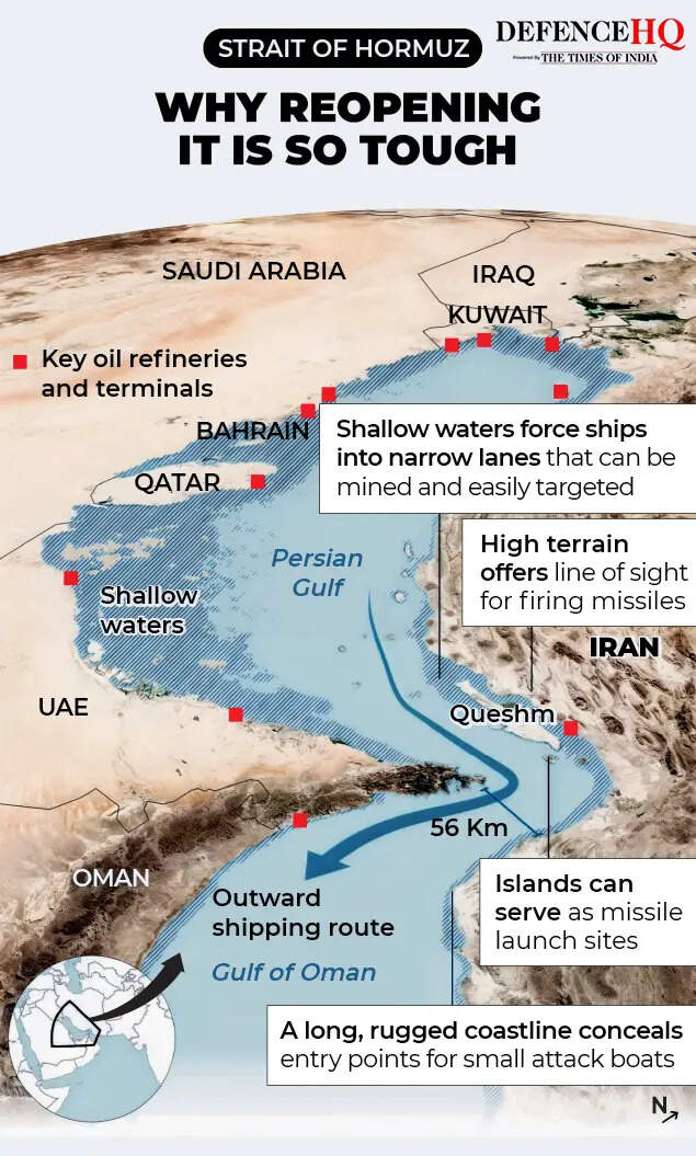
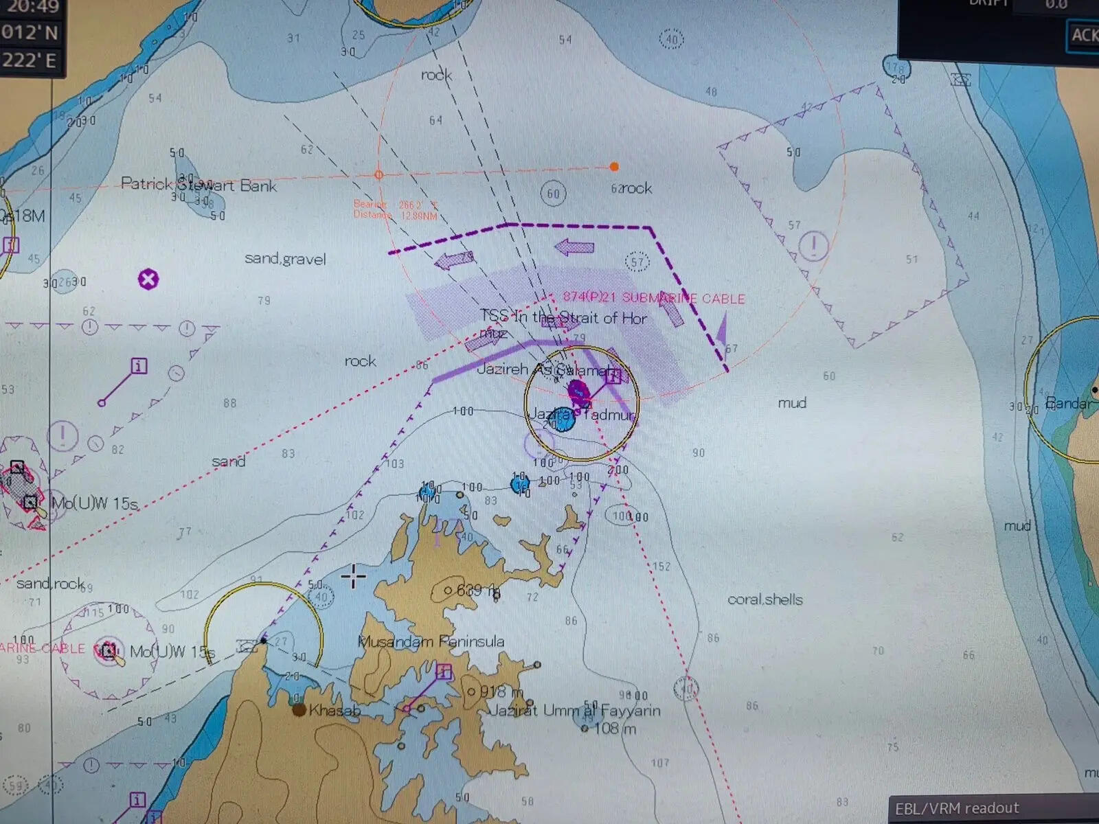
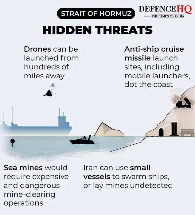
Modern shipping depends heavily on GPS for route plotting and collision avoidance, making such disruptions particularly dangerous in constricted passages like Hormuz.Adding to the risk are warnings of naval mines—explosive devices that can be triggered by contact or proximity. Kumar said ships are being given maps marking specific transit corridors. “There are arrows—entry and exit routes marked. It’s like a designated passage,” he said. Despite decades of experience navigating piracy-prone waters and conflict zones, Kumar described the current situation as unprecedented. “But this combination—GPS issues, unclear timeline, and real threats out there—this is new.”
The risks are amplified by the nature of cargo. Most vessels transiting Hormuz are oil or chemical tankers with flammable cargo. If anything happens, it can turn into a big explosion. Shipping companies have begun issuing daily “conflict intelligence briefs” directly to vessels. These combine military advisories, open-source tracking and proprietary risk assessments into real-time operational guidance.A March 25 “Middle East Conflict Daily Security Intelligence Update” warned of “extreme caution” across the region, noting continued GPS interference, elevated port security levels and unconfirmed concerns over mine-laying activity. The report compiled real-time battlefield developments, maritime incidents, airspace closures, and energy disruptions.
Likewise, a March 24 advisory by the Joint Maritime Information Center (JMIC), a US-led multinational coordination body, flagged the regional maritime threat level as “critical”. It cited 21 confirmed incidents since March 1 and ongoing “navigation interference” across the Strait of Hormuz, Gulf of Oman and Arabian Gulf. Traffic through the strait has dropped sharply—from an average of around 138 vessels a day to single-digit crossings now —amid what the advisory described as “sporadic” GPS interference. It also warned that attacks may not be selectively targeted and may occur near ports.